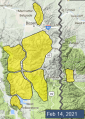
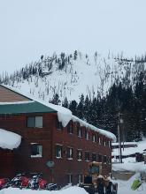
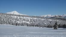
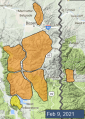
Advisory Archive
Since yesterday morning the mountains got a trace of new snow. In the Bridger Range, east wind has been 25-35 mph with gusts of 30-50 mph. Elsewhere wind has been easterly at 5-15 mph with gusts to 20 mph. This morning temperatures are teens below zero to single digits above zero F. Today temperatures will climb to single digits and low teens above zero F. Wind direction will be variable at 0-10 mph. Snow is expected tonight with 1-2” possible by morning and more through Tuesday.


There is a trace to 2” of new snow across the advisory area this morning. Temperatures range from the negative teens F to the positive single digits F. Winds are generally westerly at 5-15 mph, with gusts of 20-25 mph. In the Bridger Range and Lionhead area light winds are out of the east. Winds today will be 5-15 mph from the northwest. Temperatures will rise to the single digits F in most areas. Light snowfall today will bring a trace to 2” by tomorrow morning.


This morning there is an inch of new snow near West Yellowstone with none elsewhere. Temperatures range from -20 F in the Bridger Range to the positive teens F near West Yellowstone. Winds are generally westerly at 10-20 mph, with gusts of 30-40 mph last night, except for the Bridger Range where they are light and out of the east. Winds today will be 5-15 mph from the west and northwest. Temperatures will stay in the negatives in the Bridger Range, rising to around 0 F in Big Sky and the low teens F in West Yellowstone and Cooke City. A trace to 3” will fall across the advisory area today, with potential for a smidge more in Cooke City.


At 5 a.m. there’s a dusting of snow around Bozeman. An arctic cold front is nudging into our forecast area. Alpine at Bridger Bowl is reading -22F, while Big Sky is near 0F and other areas are near 10F. Around Big Sky and Taylor Fork wind is blowing westerly at 20-30 mph with gusts of 40-60 mph and 10-25 mph everywhere else. Temperatures will rise to zero in the north and high teens in the south before plummeting tonight to below zero in all places except balmy West Yellowstone. Snowfall later this afternoon and tonight will drop 4” around Cooke City and 2” elsewhere.


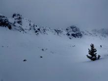
Temperatures this morning are in the single digits above and below 0 F with 10-20 mph winds from the west except in the Taylor Fork where they are blowing 30 mph. There is no new snow.
High temperatures today will be around 10 F except in balmy West Yellowstone where they will get to 20 F. Winds will be 15-20 mph from the west to southwest and the mountains around Bozeman and Cooke City will get 1” of new snow.


The Bridger and Northern Gallatin Ranges picked up an additional 6-10” of new snow, Big Sky and Cooke City got 3-4” with a goose egg in West Yellowstone. This morning, temperatures are in the single digits F and the wind is blowing 10-20 mph from the west to south. Today’s high temperatures will range from 10-20 F, winds will be 10-20 mph from the west and lingering snowfall will bring 1-2” to Cooke City with the remainder of the forecast area receiving a trace.

Since yesterday morning the mountains received 4-6” of snow near Big Sky and Bozeman, 2” near Cooke City and zero near West Yellowstone. Wind has been west-northwest at 15-25 mph with gusts of 30-40 mph. This morning temperatures are single digits to low teens F, and today temperatures will be single digits to mid-teens F. Wind will be westerly at 15-25 mph with gusts to 35 mph. Light snow showers will continue today with 1-3” possible by tomorrow morning.

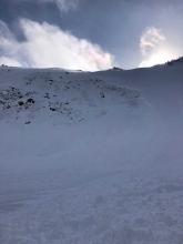
Over the last 24 hours the mountains received 8-14” of snow near Big Sky and Cooke City, 6” near Bozeman and 4” near West Yellowstone. Wind has been west-northwest at 15-25 mph with gusts of 40-60 mph. This morning temperatures are single digits to low teens F. Today temperatures will reach low teens F before dropping to single digits F above and below zero tonight. Wind will be west-northwest at 20-30 mph. Snowfall will continue with 5-7” possible near Bozeman, Big Sky and Cooke City and 1-2” near West Yellowstone by tomorrow morning.

In the last 24 hours, 12” of new snow fell in the Bridger Range, 5-7” near Big Sky and Cooke City, and 3-4” near West Yellowstone. The heaviest snowfall tapered off around noon yesterday. Winds have been strong out of the west, consistently 20-30 mph with gusts of 50-60 mph. Mountain temperatures are in the single digits F in the northern areas and Cooke City with temperatures around 20 degrees near West Yellowstone. High temperatures will be teens to low 20s F. Westerly winds will back off slightly to 15-20 mph with gusts of 30 mph.
Snowfall today will be heaviest in Cooke City. With another pulse of snow tonight, expect around a foot of fresh in Cooke City and 6-10” elsewhere by tomorrow morning.

There are 16” of new snow in the Bridger Range, 4-7” in Hyalite, the Lionhead area, and near Big Sky, and 3” near Cooke City and in the Taylor Fork. Winds are west and northwest at 15-20 mph with gusts of 30-40. Temperatures are in the single digits and teens F. High temperatures will be in the teens and low 20s F. Winds will be 15-20 mph with gusts into the 30s out of the west and southwest.
Snowfall will continue today. By tomorrow morning, 3-5” will accumulate around West Yellowstone, with 5-10” around Big Sky, Bozeman, and Cooke City.