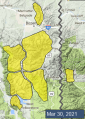
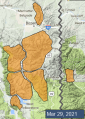
Advisory Archive

This morning temperatures are dropping to near and below freezing and will be high 20s to mid-30s F today. Wind is southwest-southeast at 5-15 mph with gusts to 25 mph, and east-northeast in the Bridger Range. Snow is expected around noon today, with some rain possible at lower elevations. Possible snowfall amounts for this storm have a wide range. By morning 2-6” of new snow is likely near Big Sky, Bozeman and Cooke City with 8-12” possible in the higher Madison, Gallatin and Beartooths.


This morning temperatures are mid 30s to low 40s F and wind is westerly at 10-20 mph with gusts to 35 mph. Today, under partly sunny skies, temperatures will reach 40s and 50s F with west wind at 15-25 mph. Weather will be different tomorrow with colder temperatures and possible snow for a couple days.


Temperatures this morning are near or above freezing (a few degrees warmer than yesterday morning). Winds are westerly at 10-15 mph with gusts of 25-35 mph. High temperatures today will be in the 40s and 50s F, similar to yesterday’s. Moderate westerly winds will continue with mostly sunny skies. Tomorrow will also be warm and sunny before the next storm system hits early in the week.


Under clear skies, mountain temperatures this morning are near or slightly above freezing. Winds are westerly at 10-25 mph with gusts of 45-55 mph. High temperatures will be in the 40s and 50s F, a few degrees warmer than yesterday. Moderate westerly winds will continue with peak gusts diminishing somewhat. Warm, sunny weather is on tap through the weekend.


This morning, skies are clear, mountain temperatures are in the high teens to mid 20s F, and wind is west to southwest at 10-15 mph with gusts of 25 mph. Under sunny skies temperatures are forecasted to hit the mid-40s in the southern ranges and mid-50s in the north and might not drop below freezing tonight. Wind will remain westerly and moderate. Tomorrow and Saturday will also be sunny and warm. I expect to hear my first lawnmower this weekend, and that’s no April Fool’s joke.
Under clear skies temperatures are in the single digits F and wind is blowing westerly at 10-30 mph, except in the Bridger Range where it is 30-50 mph. Early yesterday morning the Bridger Range got 3” of low density snow. Today will be sunny, wind will remain westerly and taper off to 10-20 mph. Daytime temperatures will reach the high 30s and fall into the 20s tonight. Clear skies and warming temperatures are the dominant weather heading into Easter weekend.


The winds eased off yesterday evening and this morning they are blowing 10-20 mph from the west, temperatures are in the single digits F and there is 1-2” of new snow. Today, temperatures will be in the upper teens to low 20s F, winds will be 5-15 mph from the west to northwest and snow this morning will deliver 1-2” before tapering off mid-day.

Since yesterday morning wind has been southwest-west at 20-40 mph with gusts of 60-90 mph, and a gust of 104 mph at Big Sky. At 6 a.m. the mountains near Bozeman and Big Sky have 1-2” of new snow with none elsewhere, and temperatures are teens to high 30s F. This morning a strong cold front is delivering snow and temperatures 20-30 degrees F colder than yesterday. Today, temperatures will be low teens to low 20s F, wind will decrease from extreme to strong at 25-35 mph out of the west, and 3-6” of snow is possible by tomorrow morning.

Yesterday morning 1-2” of snow fell near Bozeman and Big Sky with no snow elsewhere in the last 24 hours. This morning temperatures are high 20s to low 30s F and wind is west-southwest at 15-25 mph with gusts of 35-55 mph. Today, strong westerly wind will continue with speeds increasing through the day, and temperatures will reach mid-40s to 50 F. A strong cold front will arrive early tomorrow with 1-3” of new snow possible by morning and more snow through tomorrow.


Big Sky picked up 3-10” of low density new snow, while other areas only received a trace-1”. Strong winds are out of the west and northwest, gusting 30-45 mph. Temperatures are in the teens and 20s F. Westerly winds will back off a bit today, only gusting into the 20s. Temperatures will rise into the 30s and 40s F. There will be a few lingering snow showers this morning before skies begin to clear.