Advisory Archive
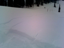
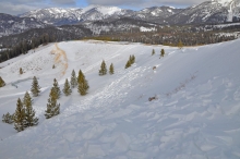
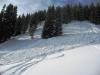
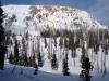
The snow gods are finally smiling on southwestern Montana. In the past 24 hours, 11 inches of new snow has fallen in the Bridger Range while northern Gallatin and Madison Ranges picked up 4-6 inches. 1-3 inches has fallen in the southern Ranges.
As this cold winter storm moves off to the east, colder and drier conditions will shift into our advisory area. High temperatures today will struggle to reach 20 degrees F with lows dropping to single digits above or below zero. Winds will remain out of the W-NW at 10-20 mph along the mountain ridgetops.
In the past 24 hours the mountains near West Yellowstone and Cooke City received 7-10 inches of snow. Big Sky and the Bridger Range received 4-6 inches, and the northern Gallatin Range got only 2. Snow was falling this morning and most areas will receive an additional 3-6 inches though I'd keep an eye on the Bridger Range where a bit more is possible.
An area of low pressure has moved east and pulled cold air down into the northern part of the advisory area with single digit temperatures this morning in the Bridger Range while other areas have temperatures in the teens F. Yesterday easterly winds slowly shifted to the south before blowing from the west this morning at 10-20 mph. Winds may increase slightly this afternoon as they continue dancing around the compass moving to the northwest. With cold air descending into the area, temperatures will only climb in to the teens to low 20s F today.

Yesterday the southern Madison Range received an inch of snow while all other areas remained dry. This morning with a major storm approaching winds increased blowing 10-30 mph from the southeast with temperatures in the teens F. Snowfall will start in the southern regions and move north before wrapping around east of the advisory area. At 4 a.m. the first wave of snow was approaching the mountains near West Yellowstone where 6-8 inches should fall by tomorrow morning. The mountains near Big Sky and Cooke City should get 4-6 inches, and the Bridger Range will receive 2-4 inches. Temperatures will only climb into the low 20s F with strong winds continuing to blow from the southeast near 30 mph. By this afternoon winds should calm and shift to a more southerly direction.
Yesterday the southern Madison Range and the mountains near West Yellowstone received an inch of snow, and today along with Cooke City they will get an additional 1-3 inches. All other areas remained dry and might see a trace of snow today. This morning temperatures were in the mid to low teens F with winds blowing from the south and southwest at 5-10 mph in Bridger Range and 10-15 mph with gusts in the 20s everywhere else. Expect winds to remain the same for most of today with a slight increase late this morning. Temperatures will rise into the mid 20s F.
Yesterday morning a trace to 1 inch of snow fell from Big Sky to the southern ranges. Light southwest winds are still blowing 5-15 mph as temperatures cooled into the teens last night from their highs in the 20s. Mild weather will continue today with temperatures reaching the low 20s, light southwest winds and partly cloudy skies. West Yellowstone may only get a trace of snow late tonight, but don't despair, snow is forecasted for late Friday.


A moist southwest flow clouded up our skies and dropped an inch of snow in the southern Madison Range last night. This morning, winds are 10-20 mph out of the south-southwest with mountain temperatures in the mid 20s. Clouds will continue today and winds will decrease tonight. In the next 24 hours weak dynamics will only wring 1-2 inches of snow in the southern mountains.
Over the past 24 hours a ridge of high pressure has brought sunny skies and warmer temperatures to southwest Montana. Today that ridge of high pressure will break down as a front approaches from the southwest. Snow and wind will arrive with this front bringing 1-2 inches to the southern mountains while the northern mountains will remain mostly dry. Strong ridetop winds out of the W-SW at 25-35 mph will be present for most of the day. Temperatures will remain warm with highs in the upper 30's and lows in the 20's. Conditions will calm this evening, but another band of moisture will move into southern Montana tomorrow morning bringing an additional 1-2 inches of snow to the southern mountains.
During the past 24 hours a westerly flow has brought cloudy skies, mild temperatures and light precipitation to southwest Montana. A trace of new snow has fallen in the Madison Range and the mountains around Cooke City. This flow will continue throughout the day today, bringing a slight chance of snow to the southern mountains and producing ridgetop winds out of the W-SW at 15-20 mph. Temperatures will stay warmer in the northern ranges with lows in the 20s and highs breaking 40 F degrees. The southern mountains around West Yellowstone and Cooke City will stay slightly cooler with highs around freezing and lows in the teens.
This morning temperatures were in the mid-high 20's F except in the mountains near West Yellowstone where they were in the teens F. Winds increased overnight and this morning were blowing in the 30's and 40's from the W and SW Today will start mostly sunny with clouds increasing this afternoon. Temperatures will rise to near 32 degrees F and winds will blow 20-30 mph from the WSW.

After 7 a.m. yesterday another inch of snow fell in most areas bringing the storm total to nearly 3 inches. Overnight partially clear skies allowed temperatures to drop into the high teens and low 20's F. Today will be partly sunny with temperatures reaching the low 30's F. Strong winds will be the most exciting part of the forecast. This morning they were blowing in the 30's mph from the W at the Bridger Ridge while blowing 15-35 mph SSW near Big Sky and much calmer near West Yellowstone and Cooke City. Expect winds to increase early this afternoon when they will blow 20-30 mph from the WSW with gust in the 40's especially in the Bridger Range.