Advisory Archive
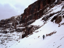
How cold is it? It's so cold that I had to put my hands in the freezer to warm them up. Yesterday, the coldest temperatures were -25 at the crest of the Bridgers. Current temperatures range from -2 near West Yellowstone to -22 in the Bridgers. Winds are currently calm but will start blowing out of the west-southwest at 20 mph later today. The only precipitation was in the mountains around Cooke City and West Yellowstone where a trace to one inch of snow fell. An arctic high pressure system will keep skies sunny and the air chilly. Mountain temperatures will only rise to single digits below zero before dropping again tonight.
In October I sat through an El Nino lecture by a meteorologist explaining how warm and dry it would be into December. Yeah, right. He's eating crow while we freeze out fanny's off and ski in snows that are 117-125% of normal around Bozeman (only 50-70% near West Yellowstone).
Southwest Montana is in the firm grip of an arctic air mass. Subzero ambient air temperatures are dominating the weather pattern. These frigid temperatures are accompanied by 15-25 mph winds out of the N-NE with light precipitation. Bridger Bowl received one inch of snow yesterday afternoon. This combination of wind and extremely cold air has created dangerous wind chill factors throughout our region, sending the real feel temperature to as low as 35-45 F below zero. Today, highs will struggle to creep above 0 F with lows plummeting to -25 F tonight. Winds of 10-15 mph will be felt at lower elevations today with ridgetop winds reaching 25-35 mph. Winds will begin to decrease early Tuesday with temperatures starting to warm on Wednesday.
A moist cold front has descended from Canada, delivering snow and cold temperatures to southwest Montana. Since yesterday morning three more inches fell in the Bridgers bringing the storm total to 12" above 8,500 ft with 6 inches falling on the lower elevations. The northern Gallatin Range received a total of 5 inches while the mountains around Big Sky picked up 2 inches with West Yellowstone and Cooke City only receiving a trace. Strong winds also arrived with this storm blowing 15-25 mph out of the N-NE. This moisture-laden cold front will exit our area by this afternoon giving way to drier and much colder conditions. Temperatures will hover around zero today with lows reaching 15-20 below zero for the next few nights. Winds will continue to blow 10-20 mph out of E-NE. These winds will generate dangerous wind chills as cold as 35 below zero, by far the coldest we've seen this season.
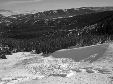
Snowfall started early this morning as a deep, upper level trough descended over southwest Montana bringing a large arctic airmass behind it. At 7am temperatures were near or just above 0 degrees F, and winds were blowing 5-10 mph from the northwest with gusts up to 20 mph. In the Bridger Range over 9 inches of the famous cold smoke has fallen near the ridge while only half that amount has fallen at lower elevations. In the Hyalite and Big Sky areas 1-2 inches has fallen, and none has fallen further south. Today cloudy skies will continue to produce snow mainly in the mountains near Bozeman where 4-6 additional inches will accumulate by tomorrow morning. 2-4 inches will fall near Big Sky and Cooke City and the mountains near West Yellowstone should only get about 1 inch of snow. Today, temperatures will drop into the negative single digits F and ridgetop winds will blow 15-20 mph from the North.
Yesterday's cold front dropped temperatures and a bit of snow. Those watching the thermometer saw it plummet from the 20s to the single digits in three hours. This quick blast of snow added another 3-5 inches from Lone Peak to the Bridgers while the southern mountains got 1-2 inches. Winds are currently west to north at 10-15 mph and should remain light through Friday. Skies will become clear and sunny until Saturday when another band of snow looks on track to hit us. Daytime temperatures will reach the 20s, but dip to below zero in the evenings.

A nice shot of snow Friday night into Saturday dropped 4-5 inches from Big Sky to the Bridgers. Only 1-2 inches fell in the southern ranges. Warm temperatures and sunny skies followed this storm making for a great weekend to get out and burn off some holiday cheer. The existing ridge of high pressure will begin to break down today as a cold front approaches from the the north. This system will bring more blow than snow, but accumulations of 2-4" can be expected in the upper elevations by Tuesday afternoon. Winds will become strong by tonight and could produce gusts up to 50 mph with the frontal passage. Conditions will improve by Tuesday afternoon, but lingering clouds and strong ridgetop winds will impact our area through Wednesday. Partly cloudy skies and cooler temperatures can be expected until the weekend.
Southwest Montana has remained in the grip of a northwest flow. Since Monday a trace of new snow fell with westerly ridge top winds blowing up to 30 mph. Winds and cloud cover will decrease as a ridge of high pressure pushes in from the west. Thanksgiving day looks like the best weather day of the week with clear skies and highs reaching into the 40's F. Winds should remain calm today, but are forecasted to blow westerly at 20-30 mph Wednesday night into Thursday. The next possible shot of snow will be Saturday night into Sunday.
Southwest Montana got a nice shot of winter over the weekend. A moist cold front came through in two distinct waves. The first came in Friday night into Saturday with the second showing up on Sunday morning. These two bouts of precipitation delivered a total of six to eight inches of snow in the Bridgers and the Northern Gallatins. Big Sky, Moonlight and the Yellowstone Club picked up around eight to ten inches. The Southern Madison Range and mountains around Cooke City recorded the most with ten to twelve inches. Lingering energy will continue to move through the area giving the mountains a slight chance of precipitation today and tonight. Moderate to strong winds will continue to blow along the ridge tops, but will die down this evening. A ridge of high pressure will build on Tuesday giving us dry and warm conditions through Thanksgiving.
No new snow has fallen since our last bulletin on November 12. Ridgetop winds were strong last weekend, but calmed throughout the week. Currently they are blowing west to southwest at 15-25 mph. Today a front is approaching from the southwest bringing cloudy skies. Tonight and tomorrow morning snowfall is expected with another storm arriving later Sunday. I'm expecting a total of 4-6 inches of new snow in the mountains by late Monday. Temperatures will dip into the teens and rise into the high 20s over the weekend and winds will continue to be breezy out of the west.

Welcome back winter! Southwest Montana has become the epicenter of a strong cold front passing over the Northern Rockies. This front has delivered widespread precipitation with the Bridgers and mountains around Cooke City receiving the most with 12-16 inches of snowfall. Accumulations in the Northern Gallatins were eight to ten inches with West Yellowstone measuring around six inches. As this strong upper level trough is pushed to the east, we can expect snowfall to taper off this evening. Clearing skies and colder temps will prevail through mid-day Friday with another round of moisture moving into the area late Friday night into Saturday. Saturday night into Sunday should stay dry with below average temps.